Strategic IT Excellence: Your Gateway to Digital Triumph
We are a leading provider of technology platforms that automate and transform collection of revenue, and administration/provision of government services
Software solutions that helps our clients reach their goals
Experienced Experts
Our experts are industrial leaders in their fields
100% Customer-centric
Our approach is to cater to the interest of our customers
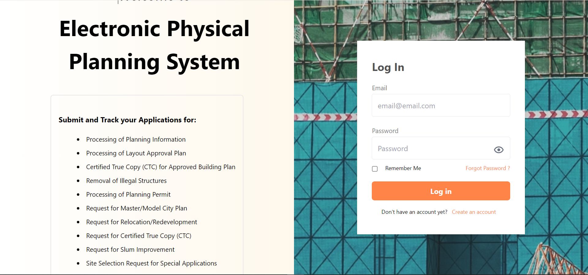
Electronic Physical Planning System (EPPS)
Electronic Physical Planning System (EPPS)
Electronic Physical planning system is a technology platform for the full automation of the core functions of any state’s ministry of physical planning and urban development, with the key objective to increase the revenue of the ministry by improving its operational efficiency.
EPPS is a one stop application and submission portal for members of the public to apply for all classes of planning permission, certifications, and other services, obtainable from the ministry of physical planning and urban development. Processing, approval, and provisional e-issuance of permits and certificates is also be carried out by officers of the ministry with this software.
3D building and structural drawings in IFC/BIM standard submitted by applicants are automatically reviewed against the state building code for compliance, while 2D drawings are available for visual review by the technical team of the ministry.
Inclusion of a geographic information system in EPPS will greatly enhance the ability of ministries to carry out more informed master planning of infrastructure and new towns, advanced land use and land cover monitoring, asset management, and to support executive economic decision making and modelling.
Land Administration Platform (LAP)
Land Administration Platform (LAP)
Our land Administration System stores all Land and Land-related data, including Ownerships, Title documents, and subsequent transactions (Deeds of Sub-lease, Deeds of Assignment). The system will also handle all financial aspects such as demand notice, receipt, valuation module etc.
The integrated GIS engine of the system will store all cadastral layers (plots, blocks, layouts), their Geo-spatial information and their linkage to all title document information. Once implemented, the system can be used by government and local authorities to increase revenues by improving planning and collection of land and property taxes.
Governments that implement our land administration system will increase its revenues by:
Increasing annual tax payments from land and property owners.
Better management of lands and properties transactions.
Fees charged responding to queries by citizens.
Enhanced mortgages and liens management.
New towns development through better master planning with GIS
Tax and Revenue Collection System
Tax and Revenue Collections System
Our Tax and Revenue Collections System is being developed to help states and municipalities of African countries build trust with taxpayers, enhance tax compliance, vastly reduce corruption, and ultimately expand the taxpayer net.
Our platform will enable successful and sustainable tax reforms, ensure the proper taxation of the digital economy, and reduce the obstacles to compliance.